
By Megan Sam
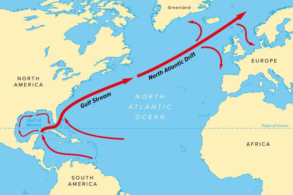
For years, scientists have warned that the Gulf Stream — a major ocean current that drives heat, weather and water circulation across the Atlantic — may be weakening or even nearing collapse. Such a shift could trigger global ripple effects: altered rainfall patterns affecting billions, more intense storms and colder winters in Europe, faster sea level rise along the U.S. East Coast, and added pressure on ecosystems like the Amazon rainforest.
But new research led by Juan Torres-Córdoba, a Ph.D. candidate in civil and coastal engineering at the University of Florida (UF), suggests a different picture: the future of the Gulf Stream is more nuanced than a straightforward study of decline.
“I wanted to see how the amount of water the Gulf Stream carries has changed over the past 30 years,” said Torres-Córdoba, who is a student affiliate of the UF Center for Coastal Solutions. “What we found is that the trend depends on where you look. To understand long-term change, we need to look across space, not just at one location, which is how many studies have approached it.”
For decades, much of what scientists know about the Gulf Stream has come from a single measurement line across the Florida Straits, where a submarine cable has provided one of the longest continuous records of the current’s strength. Many studies based on this record have suggested a weakening trend over the past decade.
Yet the evidence is far from settled. Other studies find no significant long-term decline in the Florida Current, the section that forms the headwaters of the Gulf Stream and suggest that some apparent weakening may be tied to differences in data processing or calibration rather than changes in the ocean itself. Natural variability driven by seafloor features, eddies and weather patterns adds still more complexity to interpreting these measurements.

What has remained unclear, until now, is why these findings differ and whether the Gulf Stream behaves the same way along Florida’s coast or varies from place to place. To help resolve that uncertainty, Torres-Córdoba analyzed 31 years of satellite observations and used computer model simulations across multiple sections of the system: the Yucatán Current, the Florida Current — both of which feed into the Gulf Stream — as well as several areas farther north along Florida. Working with his advisor Arnoldo Valle-Levinson, Ph.D., a professor in civil and coastal engineering at UF and CCS affiliate faculty member, he used satellites to estimate how much water the Gulf Stream moves at the surface by tracking small changes in sea level. Because satellites capture only the upper layer, high-resolution computer models were then used to reveal the full depth of the current.
The results reveal that the Gulf Stream is not changing uniformly. Signs of weakening appear near Florida, while farther north, the current remains steady — or even strengthens — as it travels up the Atlantic coast. In other words, whether the Gulf Stream appears to be slowing depends largely on where the measurements are taken.
While these findings do not settle the question of whether the Gulf Stream is broadly weakening or strengthening, they highlight a complex, dynamic system. Rather than a simple decline, the Gulf Stream shows resilience and spatial variability, behaving differently across regions and challenging assumptions based on limited observations.
“The ocean is incredibly complex, and there’s still so much we don’t understand,” Torres-Córdoba said. “I hope my research can shed light on how it works and the processes that shape it.”
Related:
Are trends of Gulf Stream transport uniform along the Florida Shelf?