Challenge
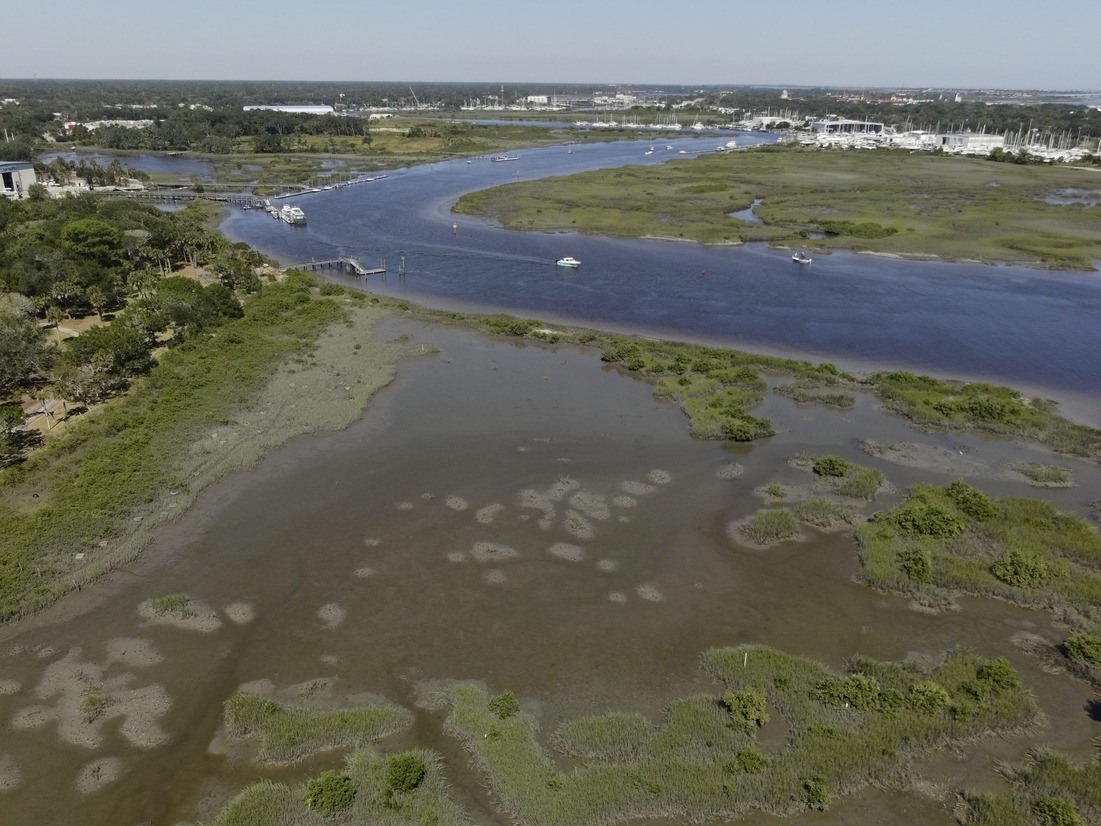
Cat’s Paw Marsh in St. Augustine, Florida is a mosaic of salt marsh, mangrove, oyster reef, oyster rake and mudflat habitats that are shrinking due to erosion and climate change.
Response
In February 2024, CCS and WSP Inc. launched a three-year project in St. Augustine that uses thin-layer placement (TLP) to bolster the ability of coastal wetlands to keep pace with sea level rise and resist erosion. TLP involves applying dredged sediment to wetlands to increase their size and elevation and is a relatively new approach to sustaining coastal wetlands especially in the subtropical southeastern U.S. By doing so, this management intervention will enhance the wetlands’ ability to protect shorelines from storm surges, adapt to rising sea levels, store carbon and provide critical habitat for wildlife.
Key activities of this $1 million project include:
- Monitoring changes in the St. Augustine wetlands and oyster reefs to identify the best sites for sediment applications, addressing the urgent need to combat rapid erosion.
- Modeling sediment movement within these ecosystems to understand how water flow, sediment and vegetation interact, and to predict how marshes would change with rising sea levels and increased boat traffic if no restoration were to occur.
- Developing an engineering design for the TLP application to increase coastal wetland elevation and for the construction of semi-permeable breakwalls to mitigate wetland erosion.
- Submitting permits to complete TLP application at Cat’s Paw marsh.
The information and experience gained through this project will guide restoration efforts throughout the southeastern United States, determining the optimal timing, location, and method for applying thin-layer dredged sediments.
Funding
This project, Phase II: Partnering with Multiple Stakeholders to Innovate Salt Marsh Restoration Techniques that Reuse Dredged Sediment, Maintain Navigation, and Protect Coastal Community Infrastructure within the Lower St Johns River Watershed (FL), is funded by the National Fish and Wildlife Foundation’s National Coastal Resilience Fund.
Partners
CCS is collaborating with WSP on this project and partnering with the City of St. Augustine, Florida Inland Navigation District, U.S. Army Corps of Engineers Jacksonville District, Guana Tolomato Matanzas National Estuarine Research Reserve, and the Florida Department of Environmental Protection. Stakeholders from coastal resilience, navigation planning and the permitting process will be actively involved throughout the project to ensure project results align with stakeholder needs.
Team Leads

Research Collaborators