Florida Sea Grant Update
by Thomas T. Ankersen, University of Florida College of Law & Florida Sea Grant
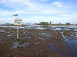
Florida Sea Grant (FSG) provides small grant funding opportunities for its specialists, affiliates, and agents to collaborate on programming to develop and apply the science, policy, and outreach in emerging areas of interest to marine and coastal stakeholders. One such effort involves linking seagrass restoration to the recreational fishing economy by targeting restoration based on the extent and nature of prop scarring and habitat- based biophysical factors.
Florida Sea Grant’s Nature Coast Regional Specialized Agent Dr. Savanna Barry and affiliate Dr. Mark Clark (UF IFAS, Soil and Water Science) are spearheading a project in the St. Martins Marsh Aquatic Preserve on Florida’s Nature Coast to employ drone technology to map and measure seagrass scarring in the Preserve. The researchers are joined by UF IFAS scientists Dr. Mike Allen (UF IFAS, Fisheries and Aquatic Sciences) and Dr. Ed Camp (UF IFAS Fisheries and Aquatic Sciences) in examining the impact of scarring and restoration alternatives on recreational fisheries and the marine economy, and FSG Legal Program director Tom Ankersen (UF Law) who is researching the legal framework for seagrass restoration alternatives.
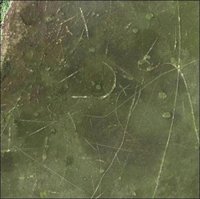
Barry and Clark have been deploying an Unmanned Aerial Vehicle (drone) to collect high resolution imagery of a 2000-acre section of the preserve and identify areas with the greatest scarring. In areas with the greatest scarring the researchers are collecting more granular data based on visual inspection to delineate, characterize, and distinguish between prop scars based on vessel type and the biophysical characteristics of individual scars. This information will help them to determine the spatial and temporal components of any future restoration.
Currently, Barry and Clark are training students and staff affiliated with the Nature Coast Biological Station to examine and classify more than 2,800 images in 4 quadrants of interest surrounding the St. Martin’s Keys. Results will be provided to local stakeholders including fishing guides, resource managers, and local leaders.

If this method proves viable, and were to be scaled up, imaging diagnostics could provide a basis for a new desk based “citizen science,” enabling disabled persons, seniors, and others who want to help the coastal environment, but whose access to traditional field-based citizen science is limited. Future research will also include examining the potential for artificial intelligence to aid in the characterization of prop scars currently being performed by visual inspection.